|
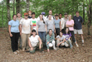
Archaeology in the Old Catawba Nation: Excavations of the 2003 UNC Archaeological Field School The 2003 UNC Archaeological Field School was held from May 20st until June 20th at the historic Catawba Indian sites of Old Town (c. 1770-1780) and New Town (c. 1800-1818) in northern Lancaster County, South Carolina. The field school was taught by Drs. R. P. Stephen Davis, Jr. and Brett H. Riggs of the Research Laboratories of Archaeology (RLA). In addition to providing training for students in archaeological field techniques, the field school excavations are an integral part of a long-term research project--the Catawba Project--initiated by the RLA in 2001 to investigate the emergence of the Catawba Nation at the beginning of the eighteenth century and its endurance into modern times. At the beginning of this project, we have sought to identify sites, using historical records (particularly maps), that can be confidently associated with the Catawba or one of their constituent groups. This new research focus is a logical outgrowth of our 20-year Siouan Project, which investigated several Siouan tribes, including the Sara, Shakori, Sissipahaw, and Occaneechi, who resided in piedmont North Carolina during the late precontact and early contact periods. After 1700, several of these groups settled with and became part of the Catawba Nation. Initial field investigations, undertaken during fall 2001 and 2002, focused on identifying possible archaeological remains of eighteenth and early nineteenth-century Catawba towns depicted on historical maps or mentioned in contemporary accounts. Historical maps suggest that the Catawba were situated primarily along Catawba River in York County, South Carolina prior to about 1760 and in Lancaster County, South Carolina between about 1760 and 1820. Three of the five town sites depicted on the John Evans map of 1756--Sucah Town, Weyane or King’s Town, and Charraw Town--have been tentatively identified below Fort Mill, and several cabin sites associated with the Catawba town depicted by Samuel Wyly in 1764 near the mouth of Twelvemile Creek also have been located. Three other later Catawba sites situated along the east side of Catawba River in Indian Land township have been identified and excavated. Two of these--Old Town and New Town--were excavated by the 2003 UNC Archaeological Field School; a third site--the Bowers Site--was excavated by RLA personnel in March, 2002. The 2003 investigations at Old Town and New Town recovered substantial material samples that reflect the adaptations and accommodations of the Catawba Nation to the rapidly changing social, political, and economic environments of the fledgling United States. Despite intense pressures occasioned by steady population erosion and increasing economic dependency, the Catawbas were able to maintain themselves as a distinct cultural and social community within their homeland. Assemblages recovered from Old Town and New Town reveal that through a combination of land rents and pottery sales, Catawba families maintained a high level of access to, and consumption of, commercially manufactured goods to create material lifestyles comparable to their white neighbors. In the near future, the Catawba Project will continue investigations at Old Town and New Town, then extend its scope to encompass mid-eighteenth-century settlements. By sequential investigation of serial communities, we hope to track the coalescence and integration of the modern Catawba Nation from its multiple origins in the nations of the Carolina piedmont. Selected field photographs and summaries of site excavations are provided below.
|