|
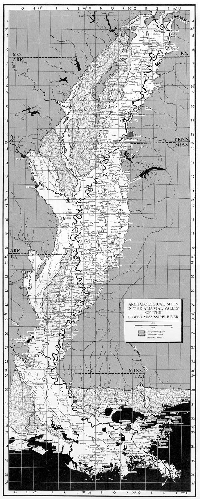
LMS Site-Numbering System Phillips, Ford, and Griffin (1951: 41) described their site-numbering system as follows: "The basis of cataloging is the grid system used by the Mississippi River Commission in mapping the area. Their quadrangle sheets, comparable to those of the U.S. Coast and Geodetic Survey, cover 15 minutes of latitude and longitude (about 14 by 17 miles) at the scale of 1:62,500. They are numbered in tiers from north to south and lettered in ranges from west to east .... Each quadrangle is accordingly designated by a number and a letter. Site 12-N-3, for example, is the third site which was encountered in quadrangle 12-N." A copy of the LMS base map, showing the grid system, is reproduced below.
[LMS Archives Overview] |